|
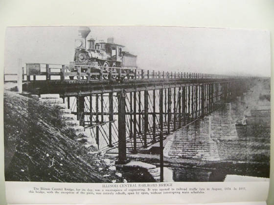
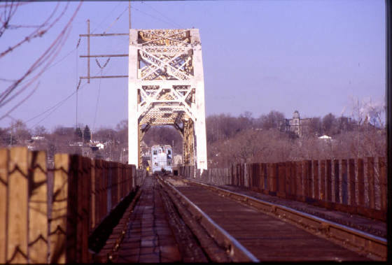
The ICRR bridge at LaSalle IL built in 1855 and still being used!
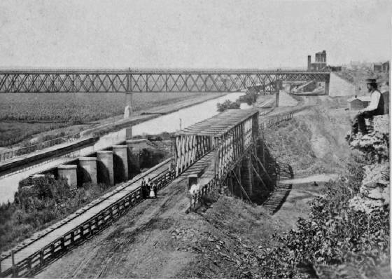
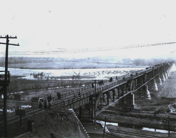
| Late 1870s view of ICRR bridge |
|
| The bridge was entirely rebuilt span by span in 1898 without stopping train movements |
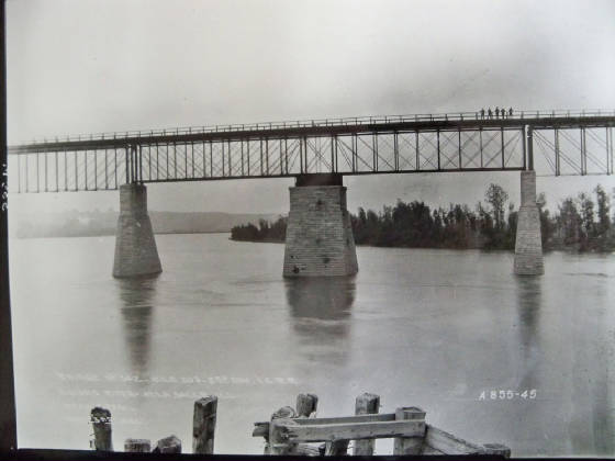
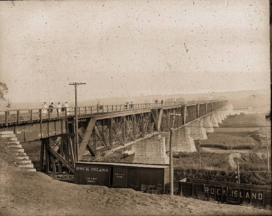
| IC bridge 1867 photo by DW Dawson seen at right |
|
| The bridge was only about 12 yrs old at this time |
| The swing span was located over the river |
|
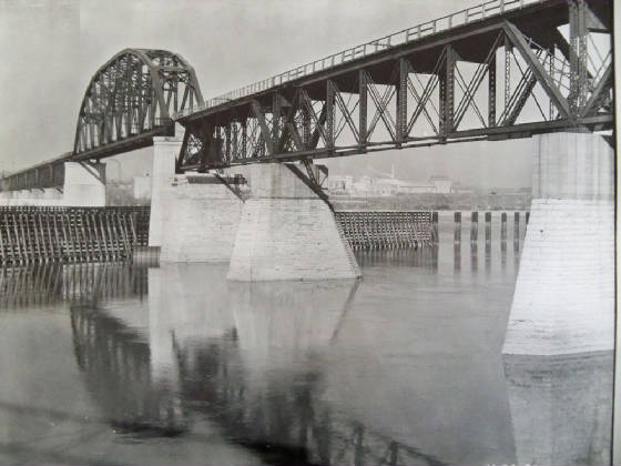
| The large Pier 6 can still be seen today which supported the swing span to allow boat traffic |
The text in the above photo is dated May 3rd 1894 and mentions It is a draw span and is located in La Salle IL.
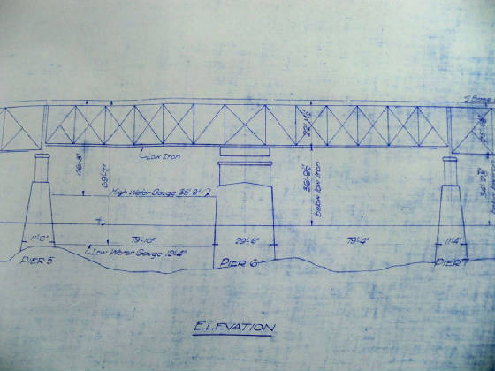
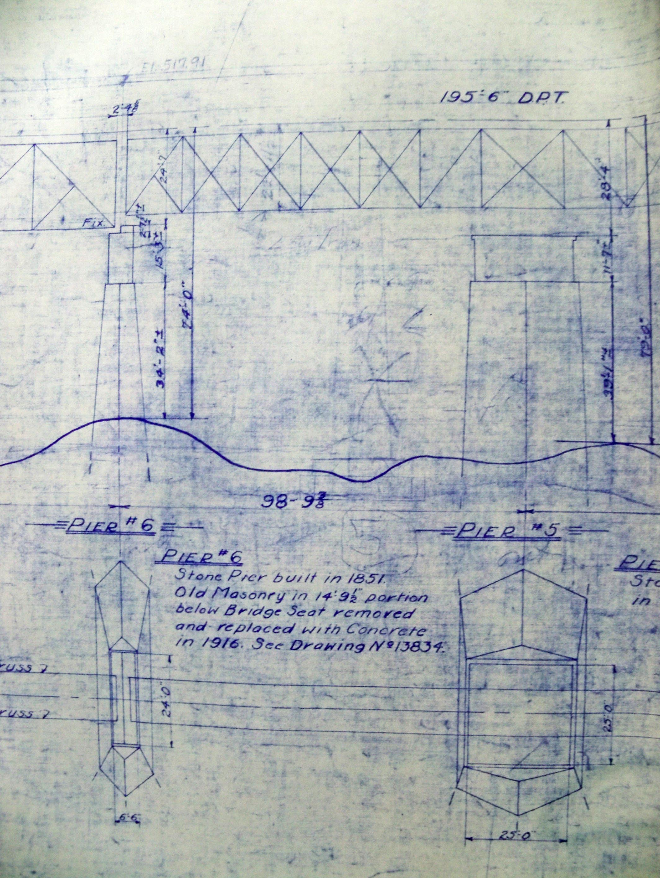
| Blueprints of the entire bridge show swing span |
|
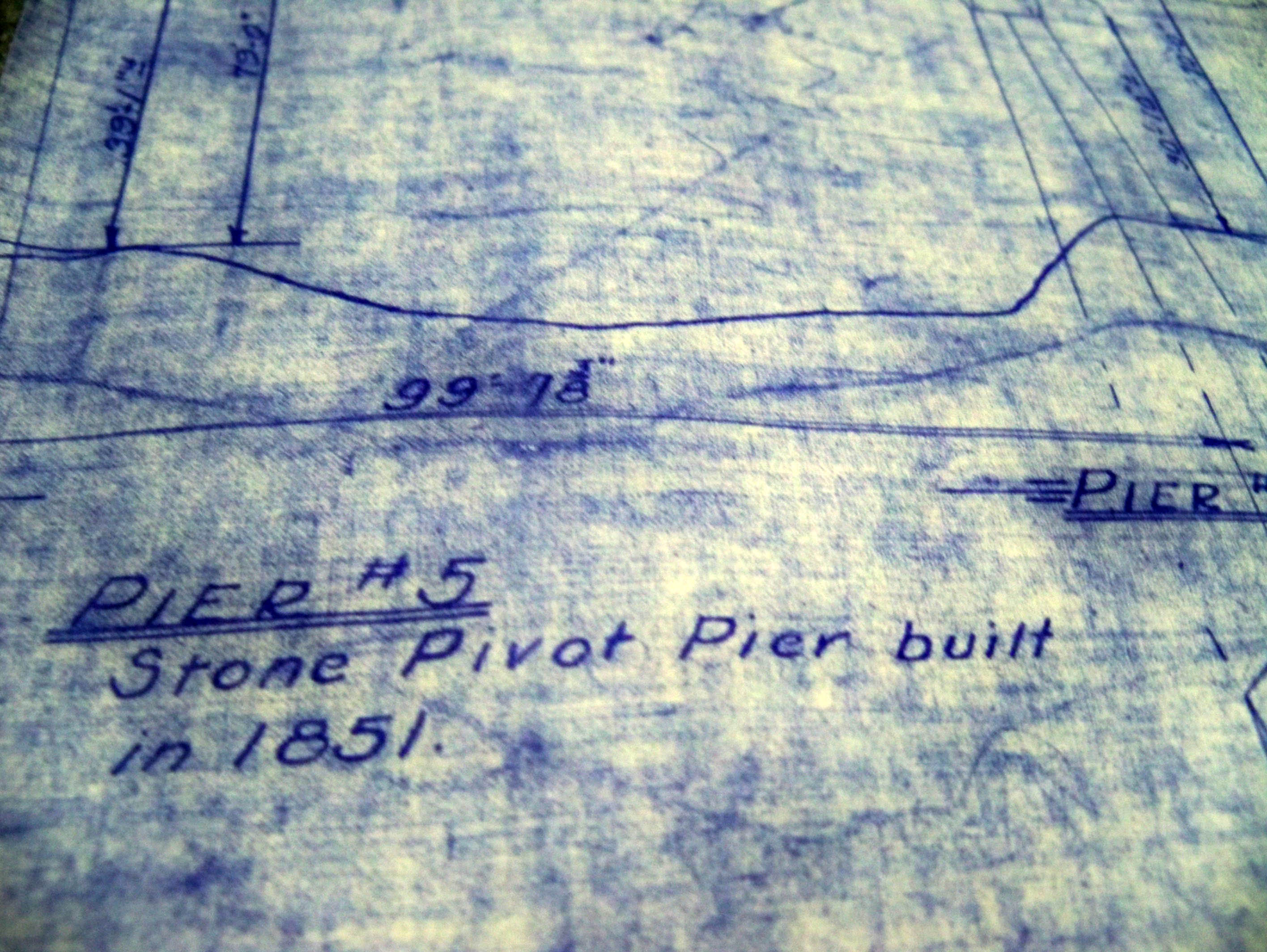
| In this drawing Pier six is the pivot pier but it was also pier five at one time. |
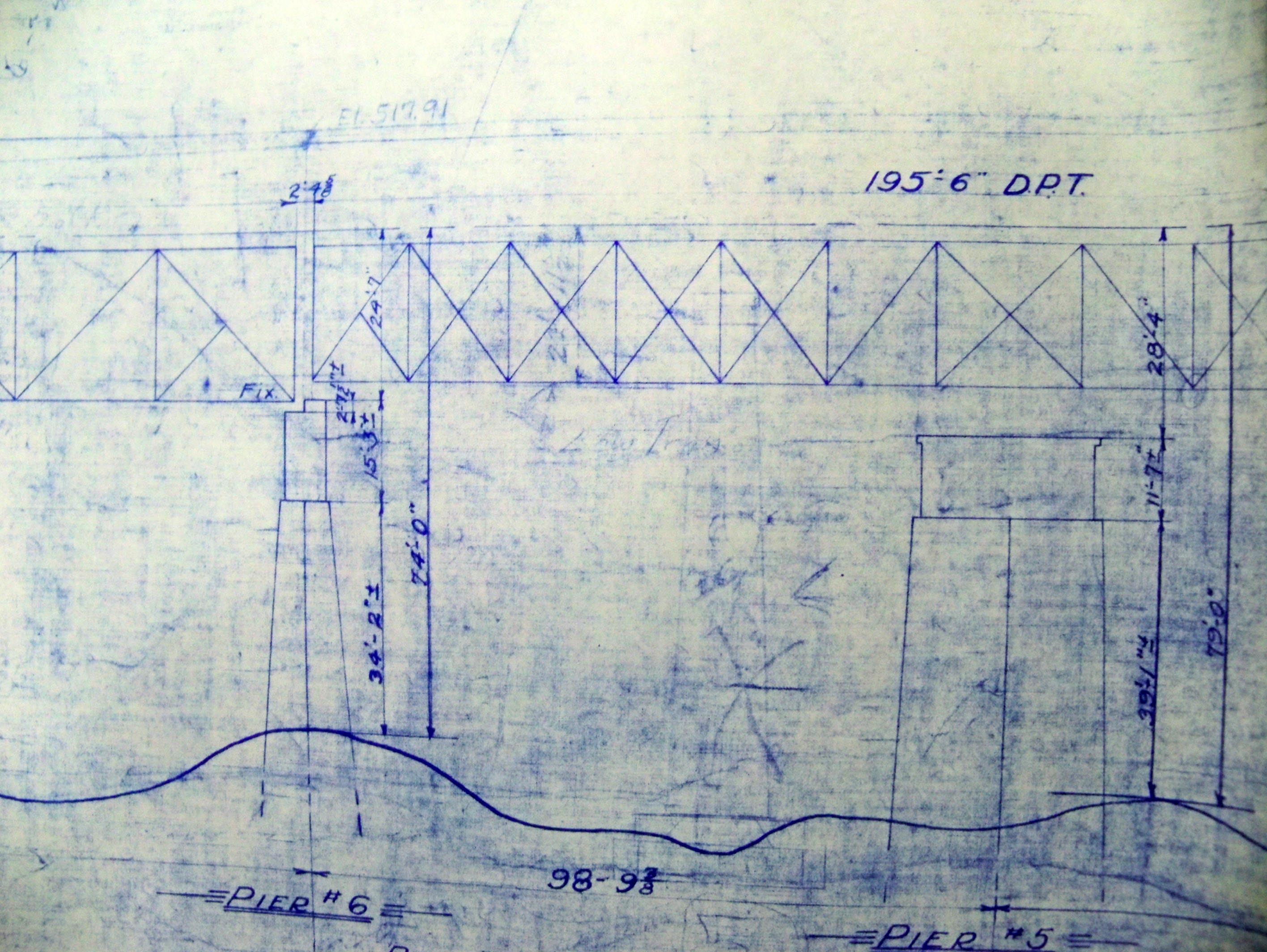
| Pier 5 built in 1851 like all the rest |
|
| Pier 5 is still visible even though it no longer supports the structure. |
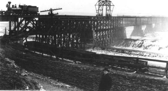
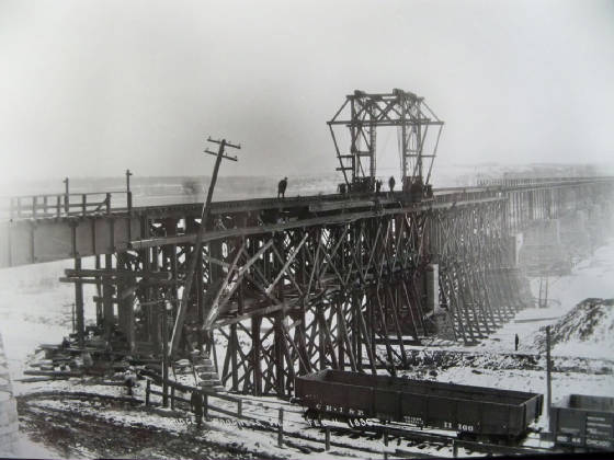
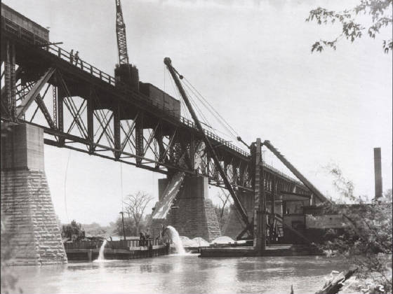
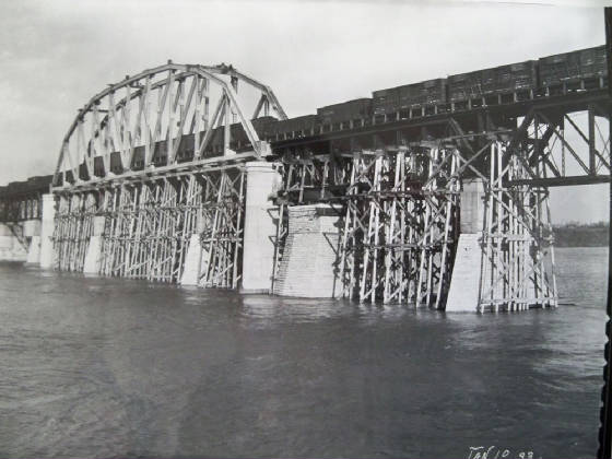
| Rebuilding the bridge in 1893 span by span |
|
| Notice the Rock Island tracks below and the inactive canal |
| Rebuilding the bridge span by span in 1893 |
|
| The ICRR did this without halting railroad traffic |
| 1920's |
|
| Notice the Interurban tracks on roadway in foreground |
| Grand opening of rebuilt bridge 1898 |
|
| Citizens were allowed to come and walk across the bridge |
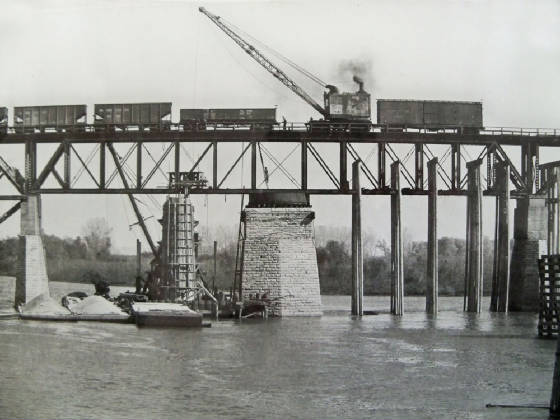
Ah ha! Look at the picture below. I have seen it several times but just noticed that the boxcar and gondolas are were
the road is (Rockwell road). The actual mainline of the Rock Island is at a lower level which can be seen in the photo above
and others. The photo below is much older than the one above. (Notice the reinforced piers above) These RR cars reveal that
the train is on an incline going up from the right to the left of the picture. There was a switch off the mainline that
went up to the coal mine. Don't confuse that one with the one that goes up to the ole ICRR yard, they were separate by about
a block or two. See the first two photos on the Coal Mine page and you will get an idea of where this track was and the coal
mine too. When the Interurban came along in the 1920's it came down the Rockwell Road hill. Very interesting! This is the
first time I ever seen train cars in this area. Steve Shutt used to tell me that the track went all the way through here from
the La Salle County Carbon Coal company which was on the side of the hill west of the bridge. You can still see remnants of
it when walking the I&M towpath when the leaves are not on the trees.
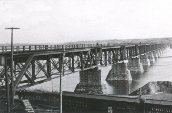
| Notice Rock Island boxcars below |
|
| Photo from Tom Romanowski collection |
| FLood of 1910 |
|
| In 1932 the building of a truss span begun |
|
| The new piers had to be put in first |
| The South concrete pier being built in 1932 |
|
| The Truss Span is in. |
|
| The trestle work and old piers now need to be removed |
| Workers install a wood fencing to protect piers |
|
| New fencing installed to protect new piers |
|
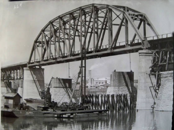
| IC bridge from cement silos |
|
| Notice the C.B.& Q. lift bridge near the truss span of the IC bridge |
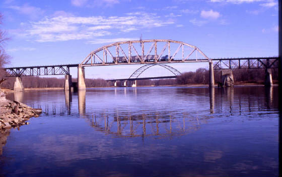
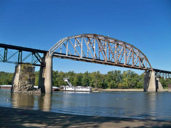
| Bridge still being used by cement co. in Oglesby |
|
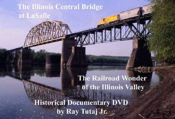
| My DVD contains many more historic photos |
|
| visit icrr.tripod.com for more info |
| Lonestar's 80-tonner crossing the bridge |
|
| Notice Hegeler Carus Mansion at right. |
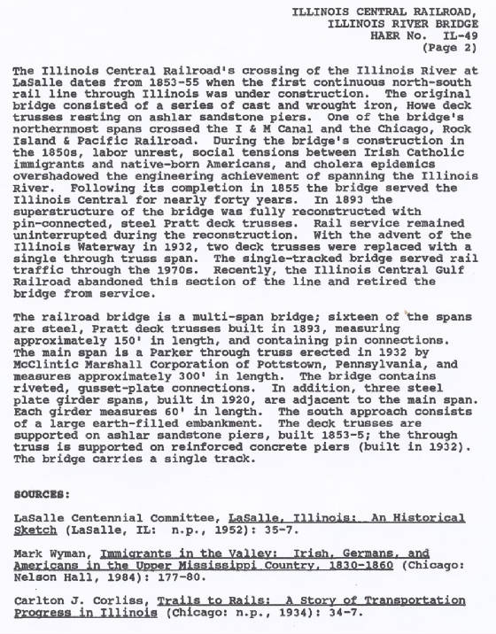
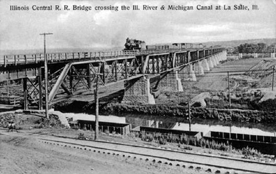
The bridge was built by the Illinois Central Railroad in 1853-55 time period and was one of the greatest undertakings
in all of Illinois at the time. It did have a swing span to allow for river traffic at some time. I have the blueprints to
the bridge and they show the swing span supported by pier 6 the largest pier of all of them. A truss span was put in about
1932 and thus made it possible for barge traffic to go directly under the truss span. The old piers were taken out. When the
water is very low on the illinois river you can see some of the old wood trestle sticking up and a large stone from one of
the two piers removed sitting in the water on the north side of the river at shore. The pier 6 still stands and is slowly
falling apart as seen here in the below photo. The bridge is still being used at this time in 2014 by Buzzi Unicem Cement
Co. in Oglesby.
| Pier 6 can be seen at left |
|
| Boats once passed through in this area on both sides of pier 6 |
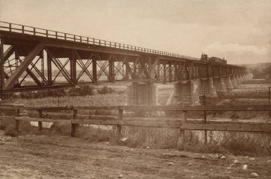
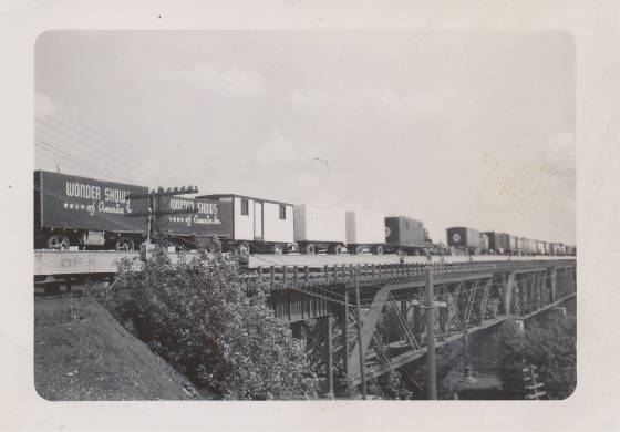
| Circus train crossing IC bridge |
|
| Steve Shutt collection |
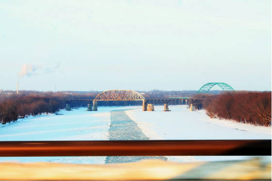
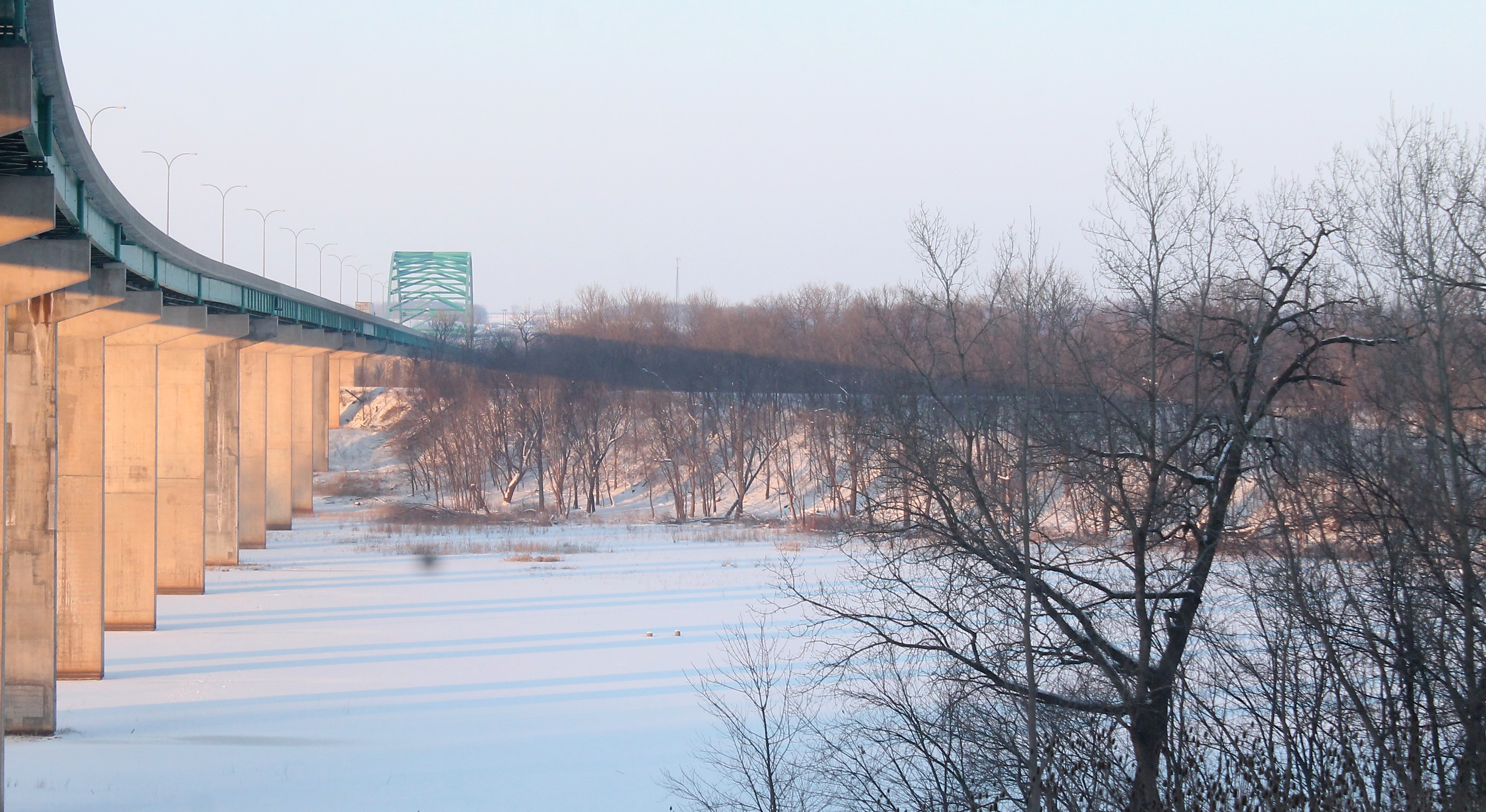
| Winter 2014 on the Illinois River |
|
| photo by Ray Tutaj Jr |
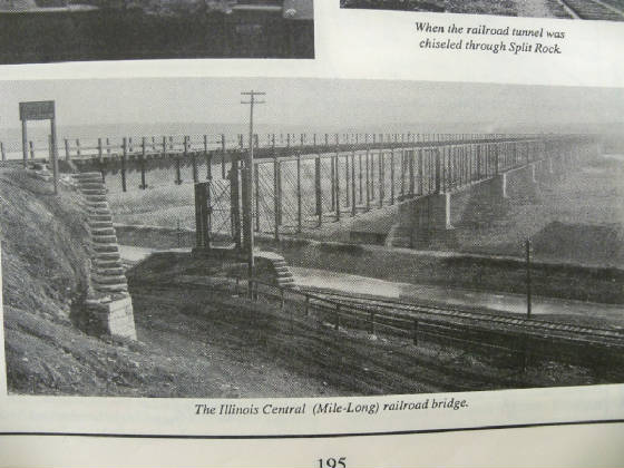
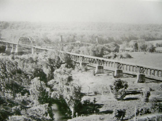
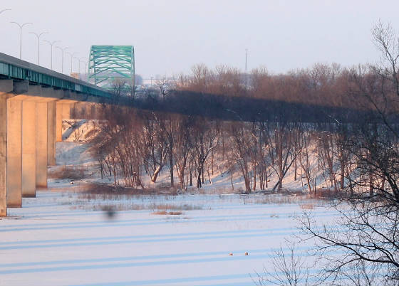
| Interstate I-39 with the ICRR fill seen in view |
|
In this winter view minus the leaves you can see the Illinois Central railroad line and how high it had to be built up.
This was no easy task in 1852-54. This fill extended all the way from near Jonesville to the river.
| CLose up of ICRR fill in distance |
|
| Shows the height of the fill |
For more information on the building of the bridge see page 35 in "An historical Sketch of La Salle." The entire book is fascinating
with exact dates of completion of the ICRR etc. (click on this text) You can click full screen to read the pages
|