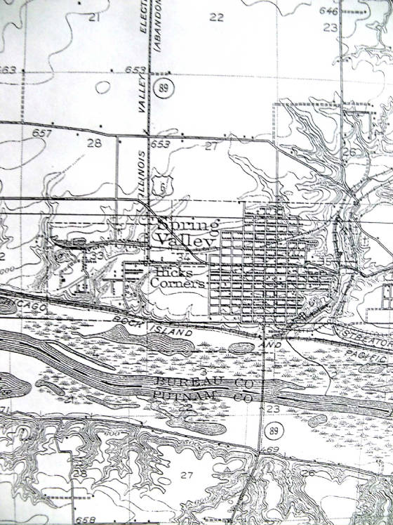
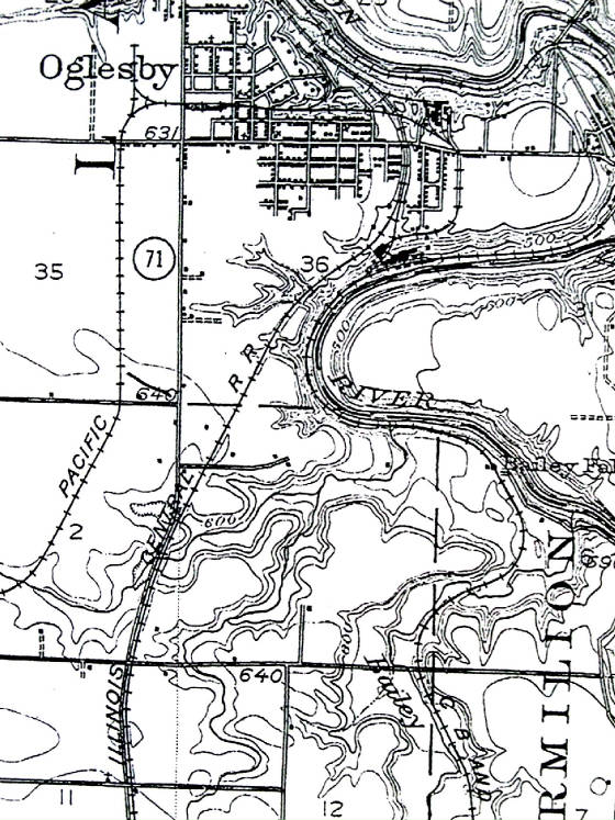
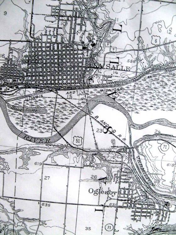
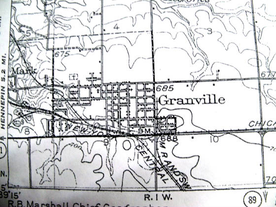
Your little La Salle County Online Museum
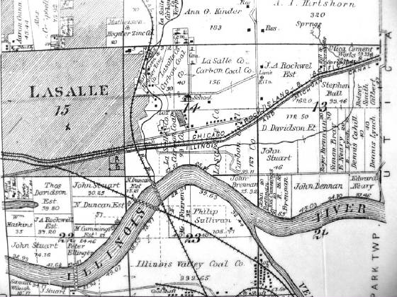
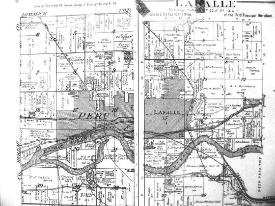
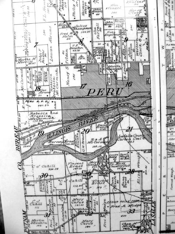
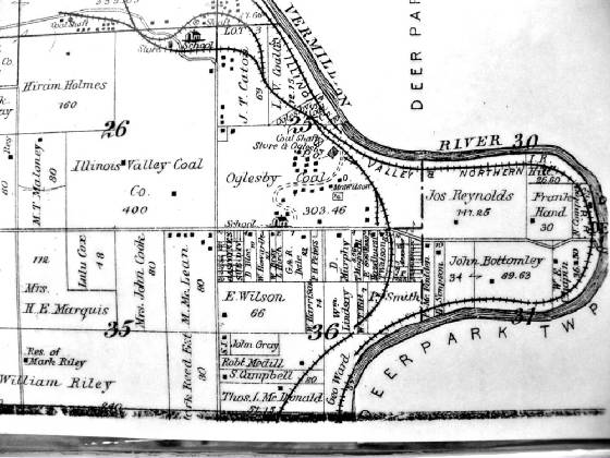
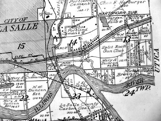
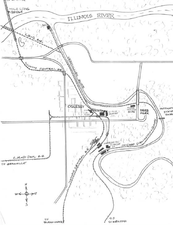
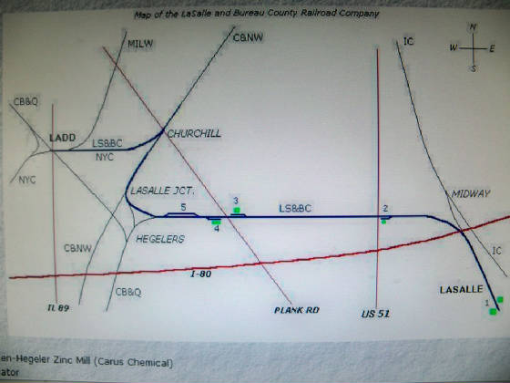
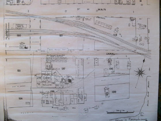
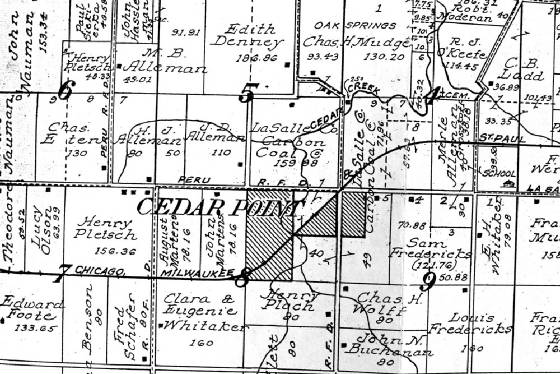
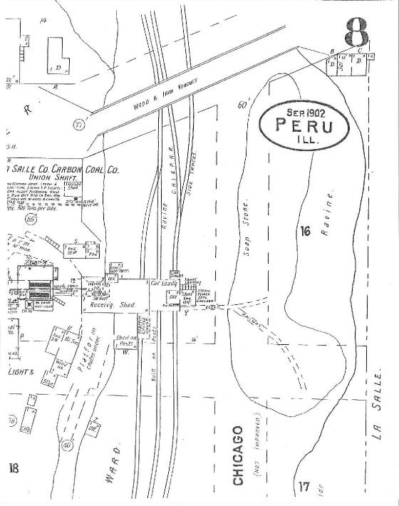
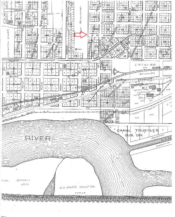
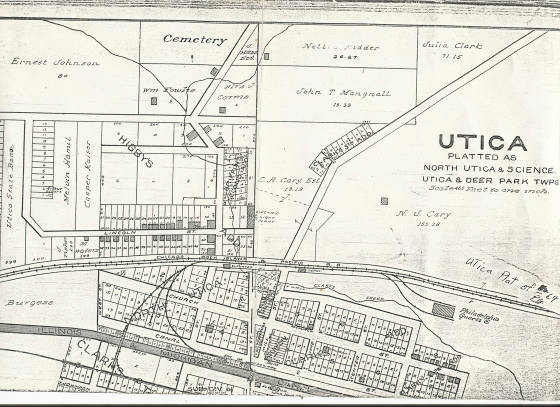
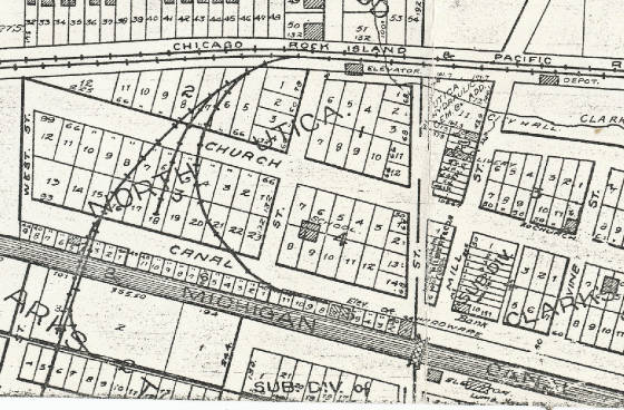
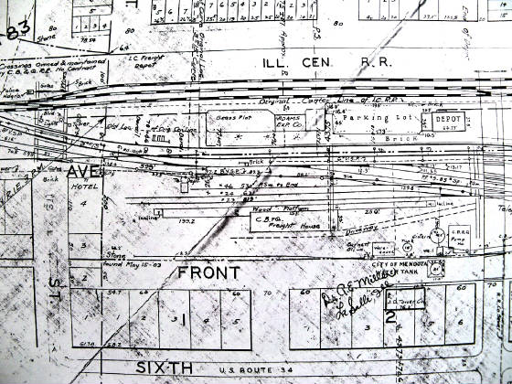
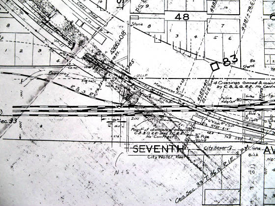
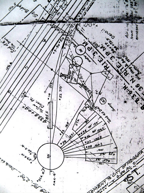
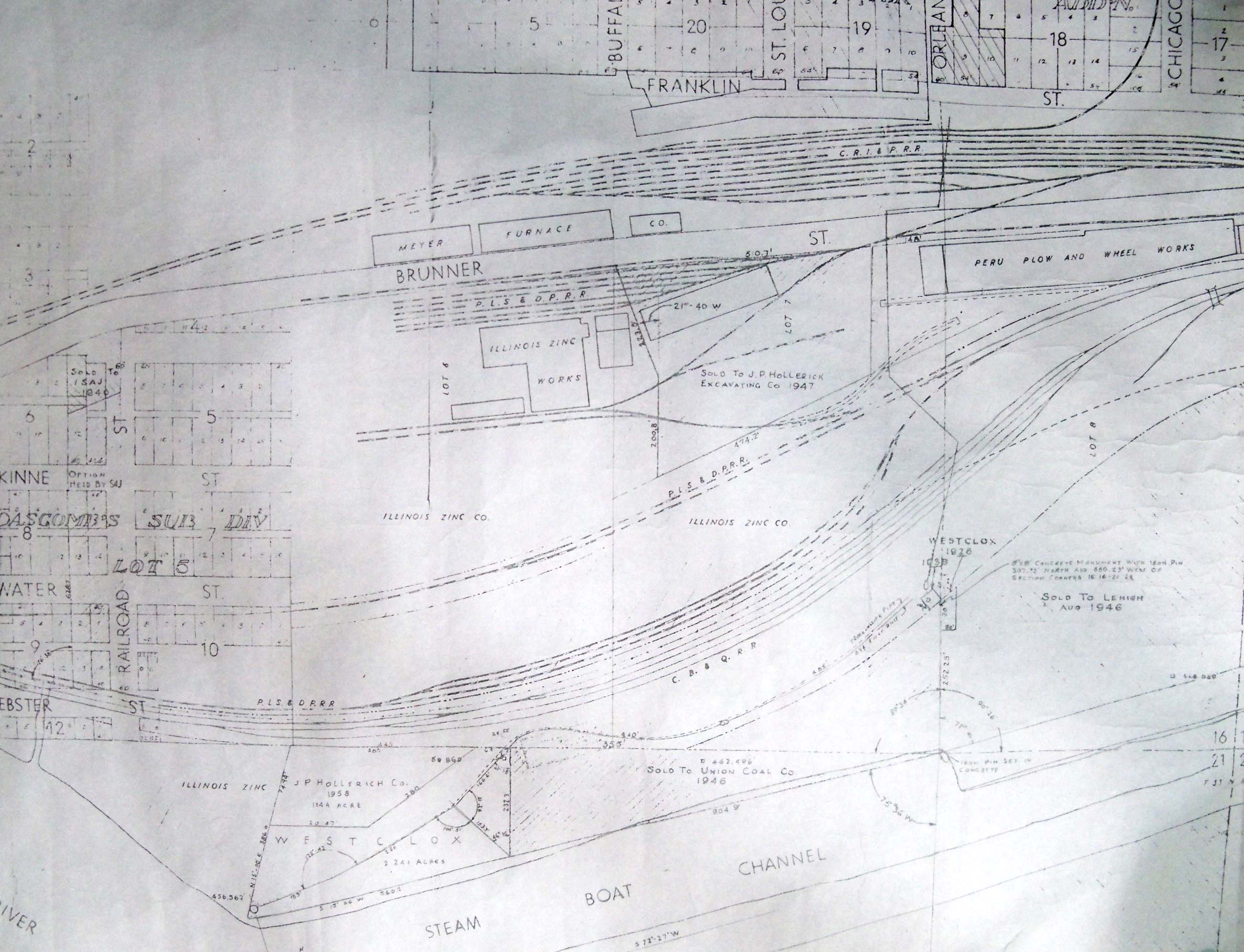
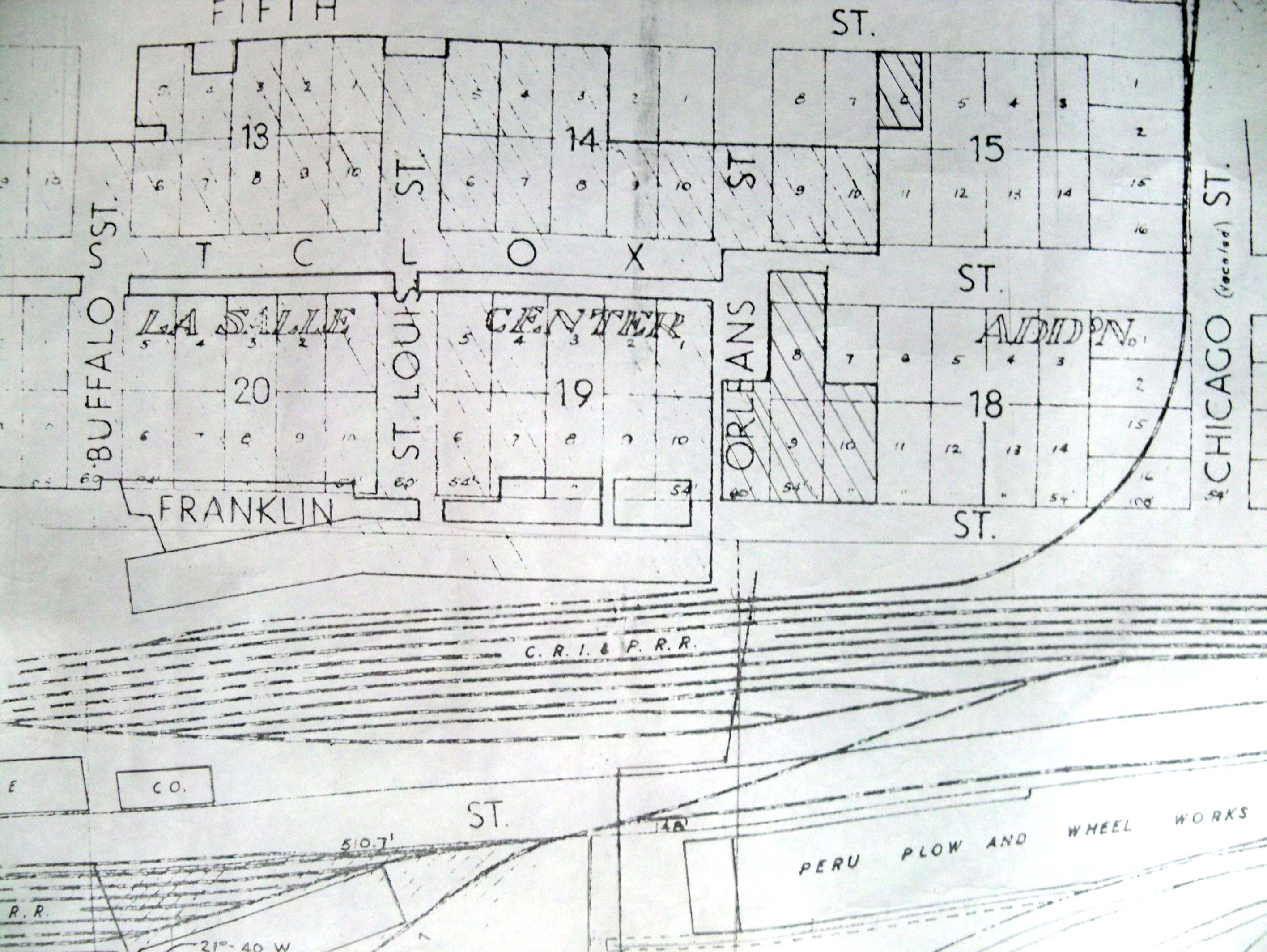
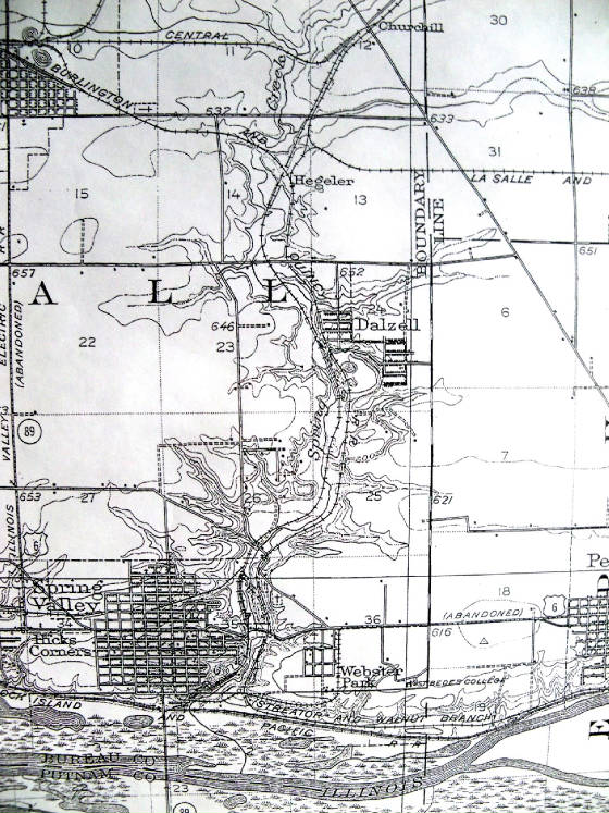
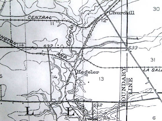
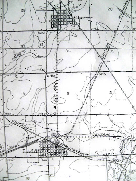
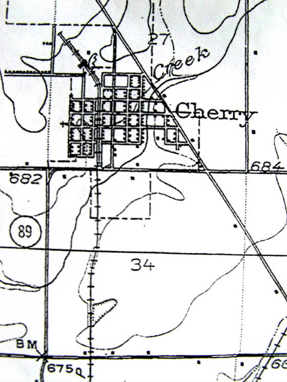
Maps


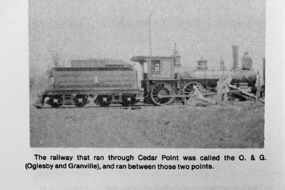
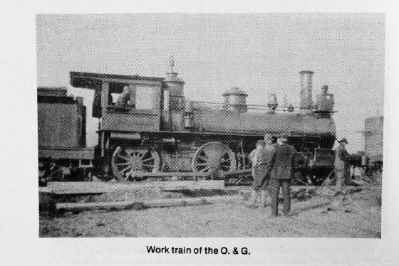
Home | The Interurban | I&M Canal | Depots | Coal Mines | ICRR Bridge | C.B.& Q. Bridge | Peru Swing Bridge | Shippingsport Bridge | More Local Bridges | The Bottom Road in La Salle | Illinois Central RR | Buzzi Train | The Milwaukee Road | CB&Q RR | BN | Rock Island RR | CNW RR | Illinois Railway | Santa Fe RR | P.L.S & D. P. RR | Lowell & Southern RR | R. T. & N. RR | Amtrak | Cement Plants | Blackball Mine | Industry & Business | Businesses Here 'n' Gone | Maps | Mendota | La Salle Aerial Photos | Water St. Peru | LSBC RR | CBQ 4978 Move | Cherry Mine Disaster | Rockwell | Ray's Model Trains | Grain Elevators | Dick's Place | Leonore Bank Robbery | History Collections | Steve Shutt Railfan | Bill Schlosser Railfan Photographer | Contact | Links to History | How You Can Help | Ray's e-books


Here below are some maps of the area including LaSalle, Peru, Ladd, Oglesby, Cedar Point, Spring Valley, Dalzell, Cherry and pictures of the Oglesby & Granville RR. Also you will find Railroad Lines that went into Ladd IL. Scroll down below!

Pre 1898 LaSalle map
pre1898lasallemapjpg.jpg

Post-1898 La Salle map
post1898lasalleperumap.jpg

Post-1898 Peru map
post1898perumap.jpg

Pre-1898 Oglesby area
pre1898oglesbymap.jpg

Post 1903 shows Interurban line
tpost1903interurbansplitrock.jpg

Railroad Lines in the area of LaSalle and Oglesby
lasalletooglesbymaprrs.jpg

Railroad Lines into Ladd
laddlsbcmap.jpg

Illinois Valley Northern RR and Rock Island
illinoisvalleynorthernrailroadandrockislandlasalle.jpg
LaSalle IL

Cedar POint and The Milw Road RR
cedarpointshowingcmstpline.jpg
The Oglesby and Granville RR first operated this line

theoglesbyandgranvillerrearly1900s.jpg

theoglesbyandgranvillerr1900s.jpg

St. Marks ravine map- see the MORE BRIDGES link
stmarksravinemaps2.jpg
Located at Peru east city limits

ST. Marks st Peru 1906 platbook map
stmarksstreetperu1906platbook.jpg

UTICA MAP
uticamap.jpg

UTICA MAP 1929
uticamapcropped.jpg

MENDOTA
mendotatracksneardepot.jpg

Mendota
mendotadiamondsrochellensouthern.jpg
Notice R & S Ry (Rochelle and Southern) Milwaukee Road

Mendota CB&Q tracks 1st ave area
sevenstallenghsecloseup.jpg

CB&Q RR and Deer Park RR at La Salle
largeviewrockcbqderrparkrrs.jpg

ROck Island behind Westclox at La Salle
rockislandydbehindwestclox.jpg

Peru La Salle and Deer Park RR
perulasalleanddeeerparkrryard.jpg
The Yard was between the Rock Is and CB&Q yard in LaSalle

aladdandhegeler2.jpg

aladdandhegeler.jpg

aladd.jpg

achurchilltospringvalley.jpg

achurchilltodalzall.jpg

achurchillandhegeler.jpg

acherrytoladd.jpg

acherry.jpg

aspringvalley.jpg

aoglesbymap.jpg

alasalletooglesby.jpg

agranvillemark.jpg

adimmick.jpg

adalzell.jpg
CHicago North Western and CB&Q next to each other

Very early maps
map_image.gif

map_image2.gif

map_image3.gif
Thanks to Bill G. for sending these pics of very early maps


Sharing things you might be interested in such as local history, photography, transportation, a novel and art.