
|
|
The Rock Island came to La Salle just a few years after the I&M canal opened (1848). I do believe it was around 1852
the first RI train came through. IT sure put a dent in the canal's business and eventually the canal shut down after
about 67 years of operating. The Rock Island shut down operations in 1980, and so did Westclox close doors
on the very same day. The Rock had a fairly big switching yard in La Salle located behind Westclox. They interchanged
mainly with the CB&Q RR and the ICRR. They also interchanged with the Peru, La Salle & Deer Park RR earlier
in the 1900s. The Rock Island had numerous passenger trains among freight trains, with a double track mainline. (If
anyone has some more detailed info, I would sure be glad to have it)
|
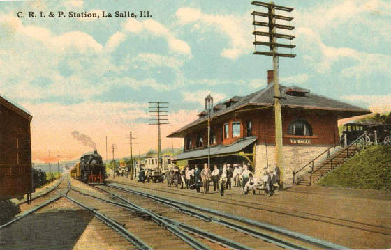
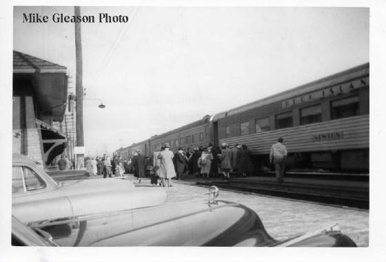
| The Chicago, Rock Island & Pacific Railroad (The Rock Island RR) |
| La Salle IL in the 1950s |
|
| Photographer wanted to remain Anon. |
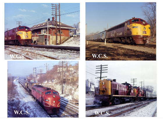
The Iowa Interstate RR (IAIS) began on November 2nd, 1984. It stretches from Chicago Illinois to Omaha Nebraska using
the former Rock Island RR line. La Salle is Milepost 99 from Chicago.
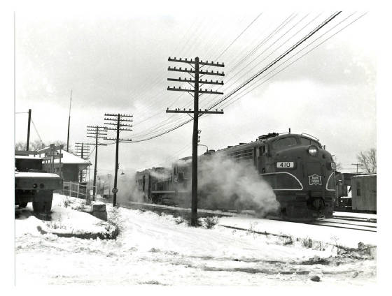
| Toward the end of the Rock Island operations 1979 |
|
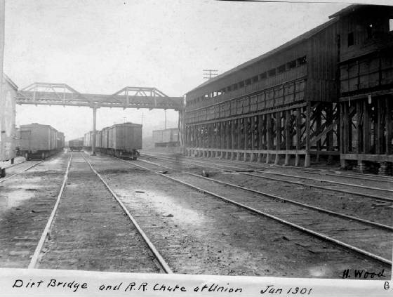
| Behind Westclox January 1901 |
|
| Westclox would be off to the right behind the coal facilty |
| Rock Island Depot in LaSalle IL |
|
| Rock Island Depot La Salle IL |
|
| Anon. |
| Bridge near Blackball mines east of Split Rock |
|
| Rock Island Line |
| Looking West toward Split Rock |
|
| Before Trolley bridge was built. Pencil sketch not mine |
|
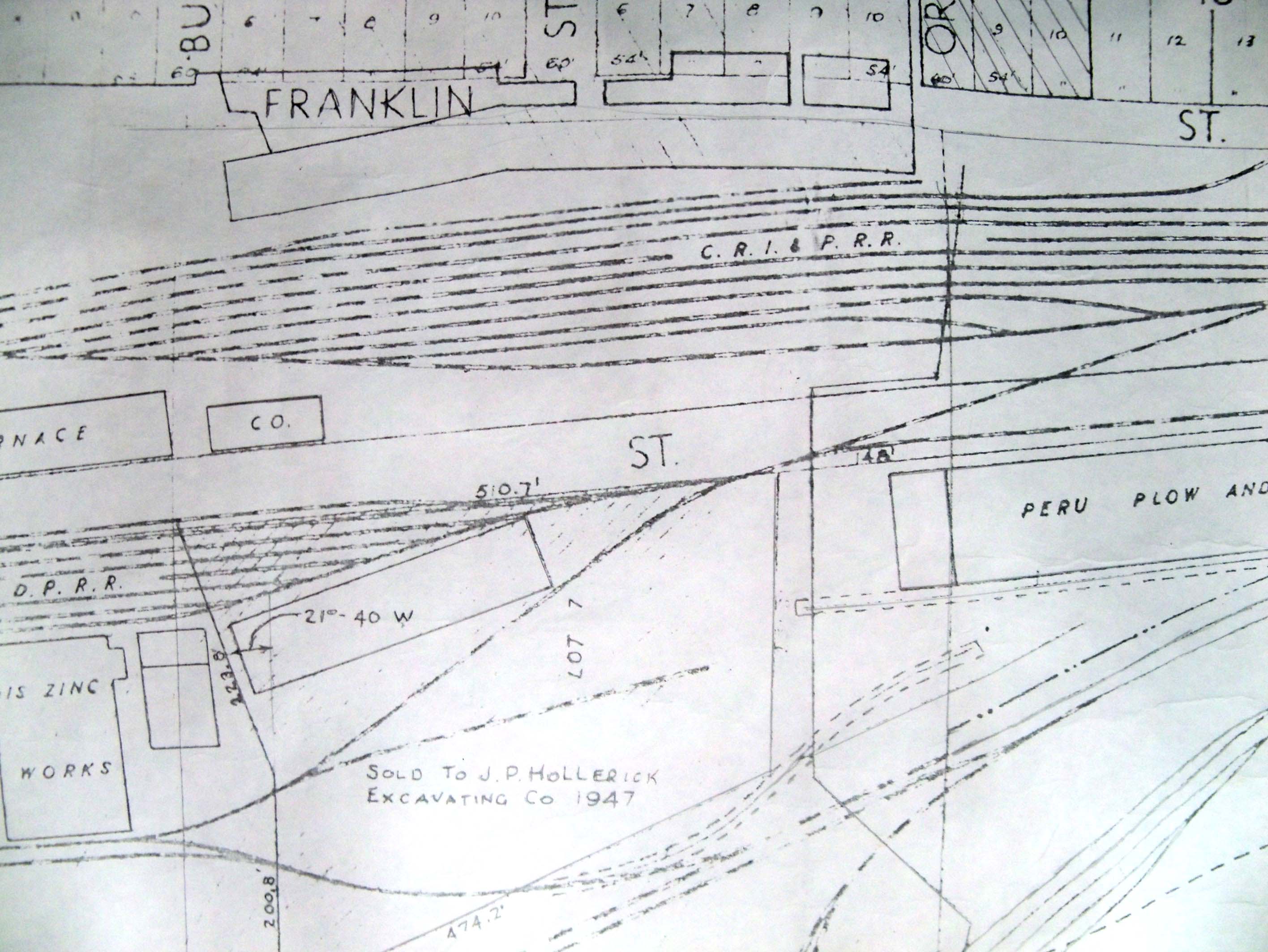
| Rock Island Yard behind Westclox 1947 |
| Railroad Yards behind Westclox |
|
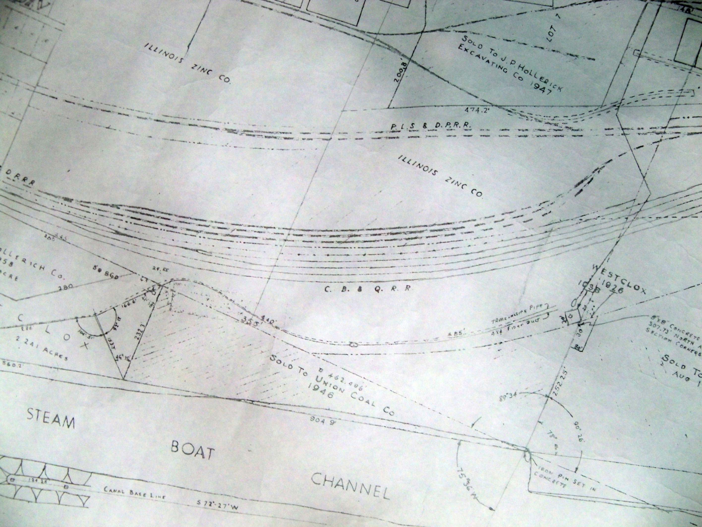
| The Rock Island, Peru, La Salle & Deer Park RR and the CB&Q RR |
|
| 1963 Aerial photo of LaSalle yards by leo Muhlach |
| CLoseer view of Rock IS and PLS&DP RR |
|
| Thanks to Steve Shutt for finding this info. |
|
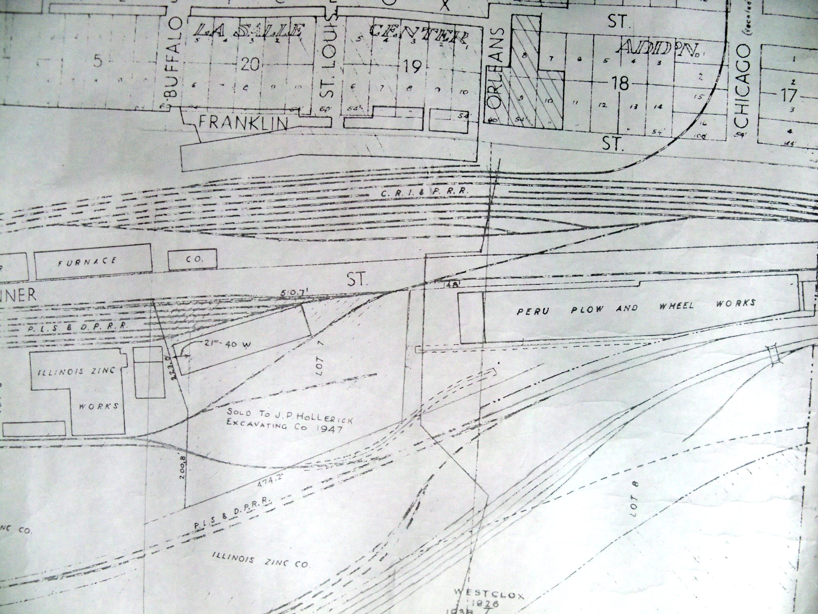
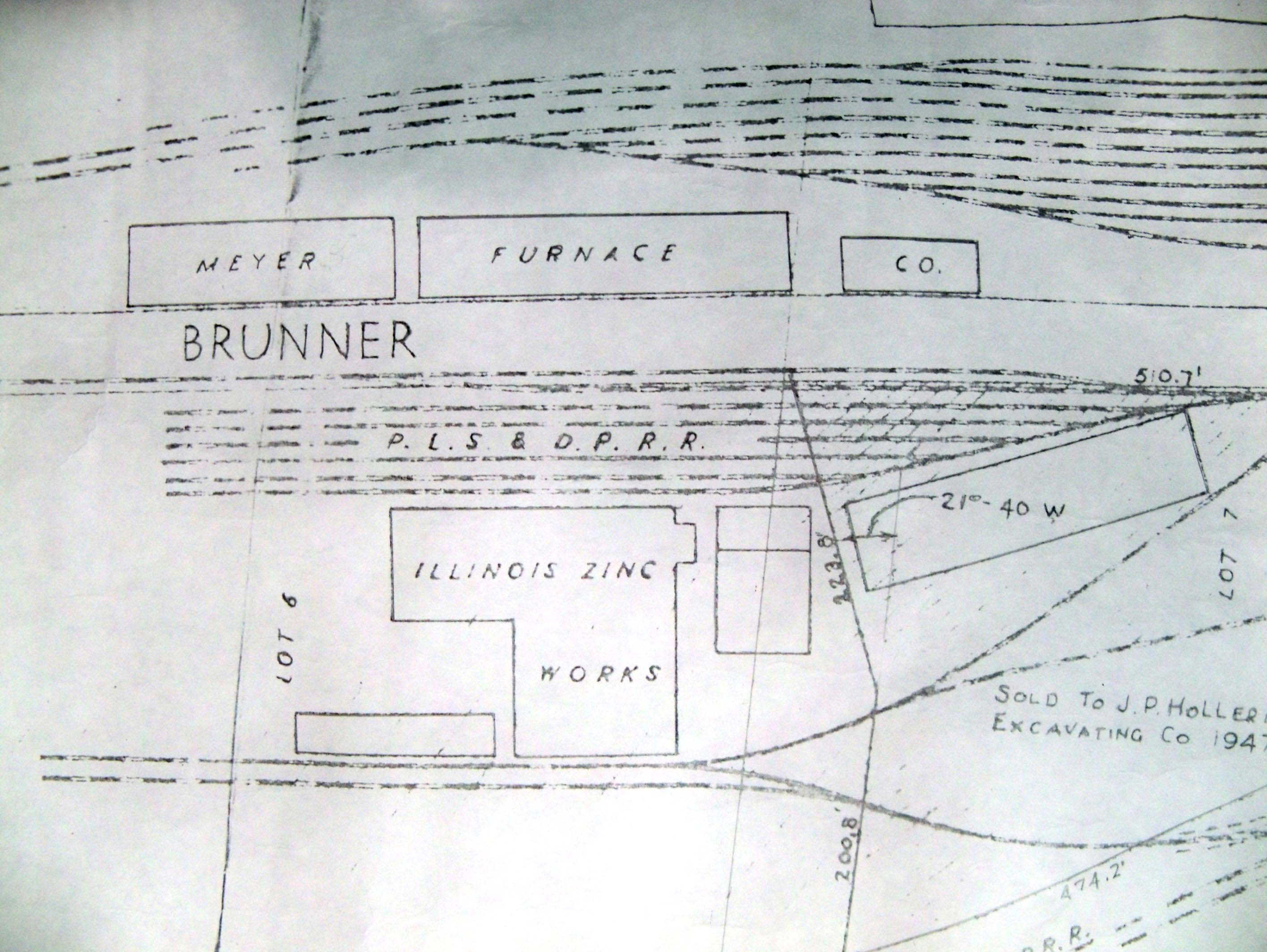
| The Peru, La Salle, and Deer Park Railroad Yard 1947 |
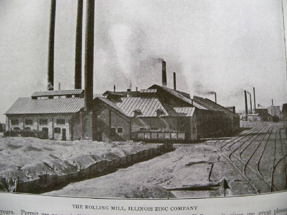
| The Illinois ZInc Works (See Map above) |
|
| Here is the P. L. S. & D. P RR yard which serviced Illinois ZInc Co |
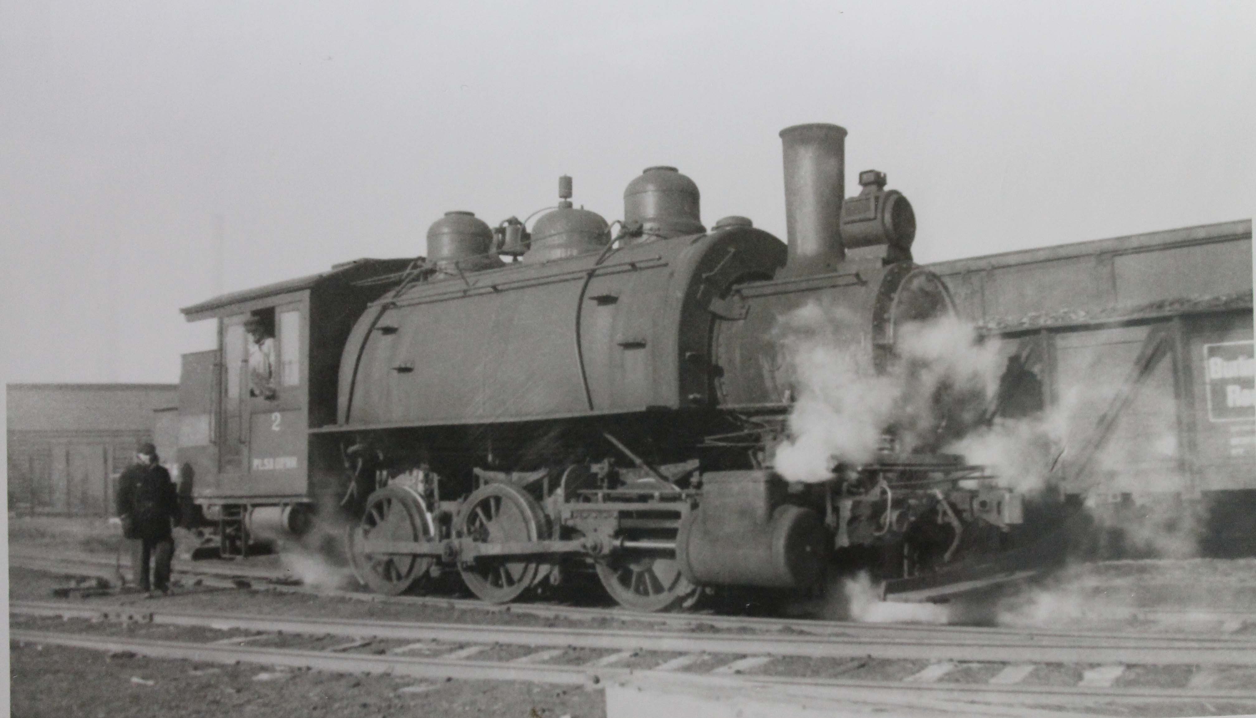
| A locomotive of the P. L. S & D. P. RR |
|
| The Peru, La Salle and Deer Park Railroad |
|
| Another view of the Rock Island yard |
| Looking SE with Westclox behind photographer |
|
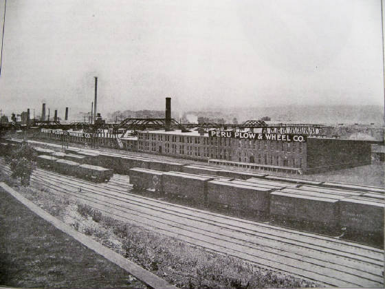
| Peru Plow and Wheel with Rock Island yard in foreground - Westclox would be at left |
|
| CB&Q yard in La Salle was very close to Rock Island's yard |
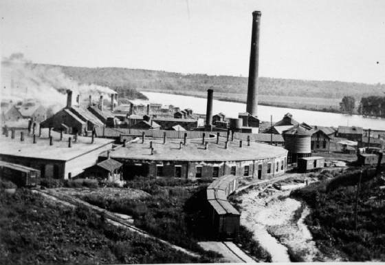
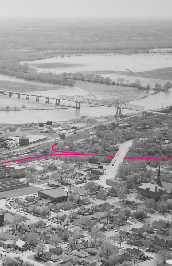
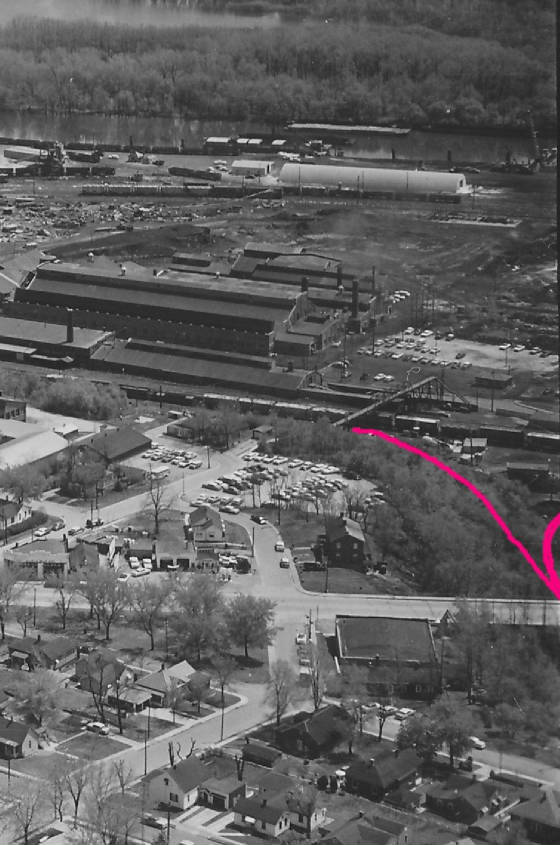
The photograph below is from very early 1900s and shows the Rock Island engine house which was west of Westclox.
This view is looking southward where the IL river cuts southward where the I&M canal meets the river. You can see the
little inlet toward the steamboat basin/ I&M canal if you look careful. The WYE track behind the engine house allowed
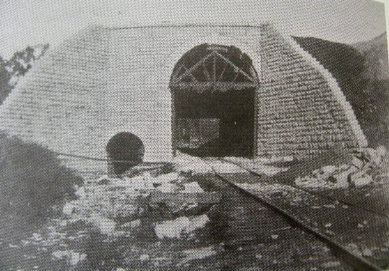
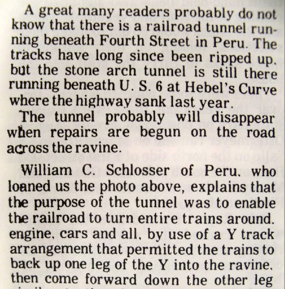
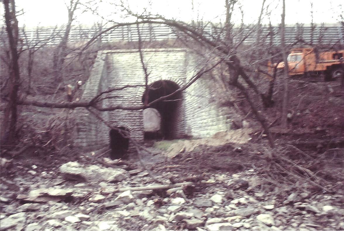
trains to turn around and face the opposite direction. A tunnel (see pic below) went underneath route 6 (4th) street in Peru.
The Rock Island mainline is in front of the roundhouse. Notice the water tower there too. The roundhouse is where the railroad
store steam locos and maintained them. A turntable track could select any of the stalls where an engine was and direct it
on to the mainline tracks. A water tower for the steam engines was nearby to the right of the roundhouse. A coaling facility
was in the RR yard toward the back of Westclox. A photo of that can be seen in one of the above pictures when you scroll upwards.
| Rock Island Roundhouse Peru IL |
|
| Notice IL river in distance. NOTICE WYE track too |
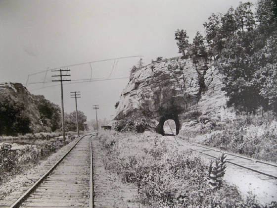
| The 4th st tunnel where the WYE went thru |
|
| clipping from local paper expalins tunnel |
|
The following four photos were shot by Leo Muhlach. He had prints made from his negatives a year before he passed away
in Dec of 2012. Since 1992 I bought photos from him and I am extremely grateful to him.
| PInk line shows where the WYE track was |
|
| View is looking Southwest |
| Pink line shows where Wye track once was |
|
| Looking NE with Westclox in view at right |
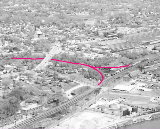
|
| PInk line depicts where track once was |
| The tunnel in 1976 |
|
| Photo by Eugene Smania |
|
|
|