|
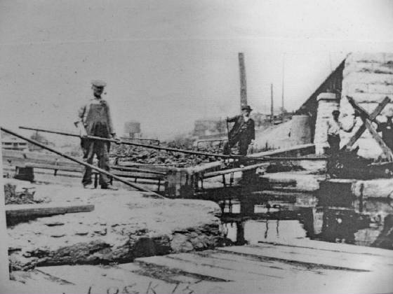
| LaSalle Lock 15 looking east |
|
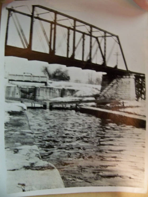
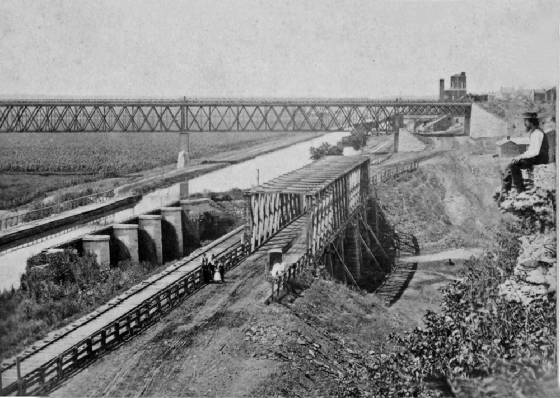
| CB&Q RR bridge above and Hwy bridge over Lock 14 |
| Taken in the Split Rock Area 2 mi east of LaSalle |
|
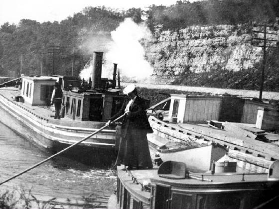
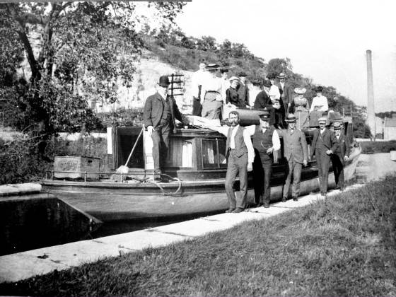
| A woman stands upon a packet/passenger boat |
| Notice barge at a dock |
|
| Very early view of Split Rock Area |
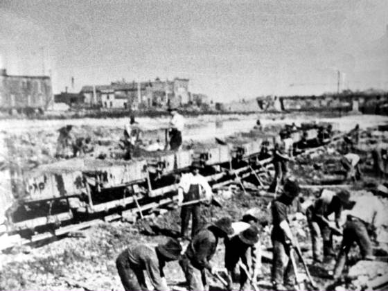
| Building the canal in 1840's |
|
| Lock Tender's house near lock 13 by Split Rock |
|
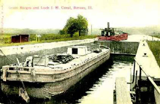
| The canal boat in the basin at lock 15 LaSalle IL |
|
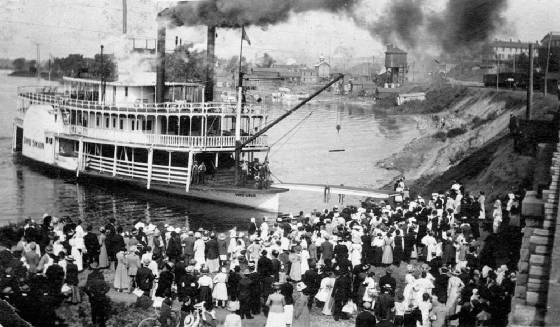
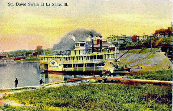
| David Swain is the name of the Steamboat |
| LaSalle 1867 with Aqueduct in view plus IC bridge |
|
| The photographer DW Dawson is seen at right |
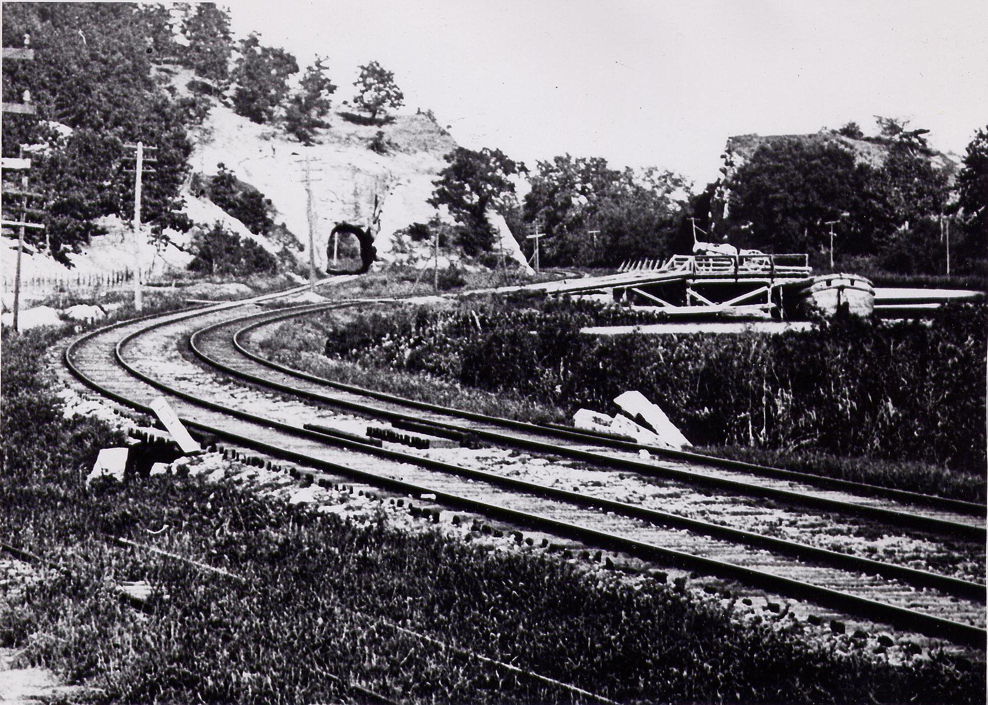
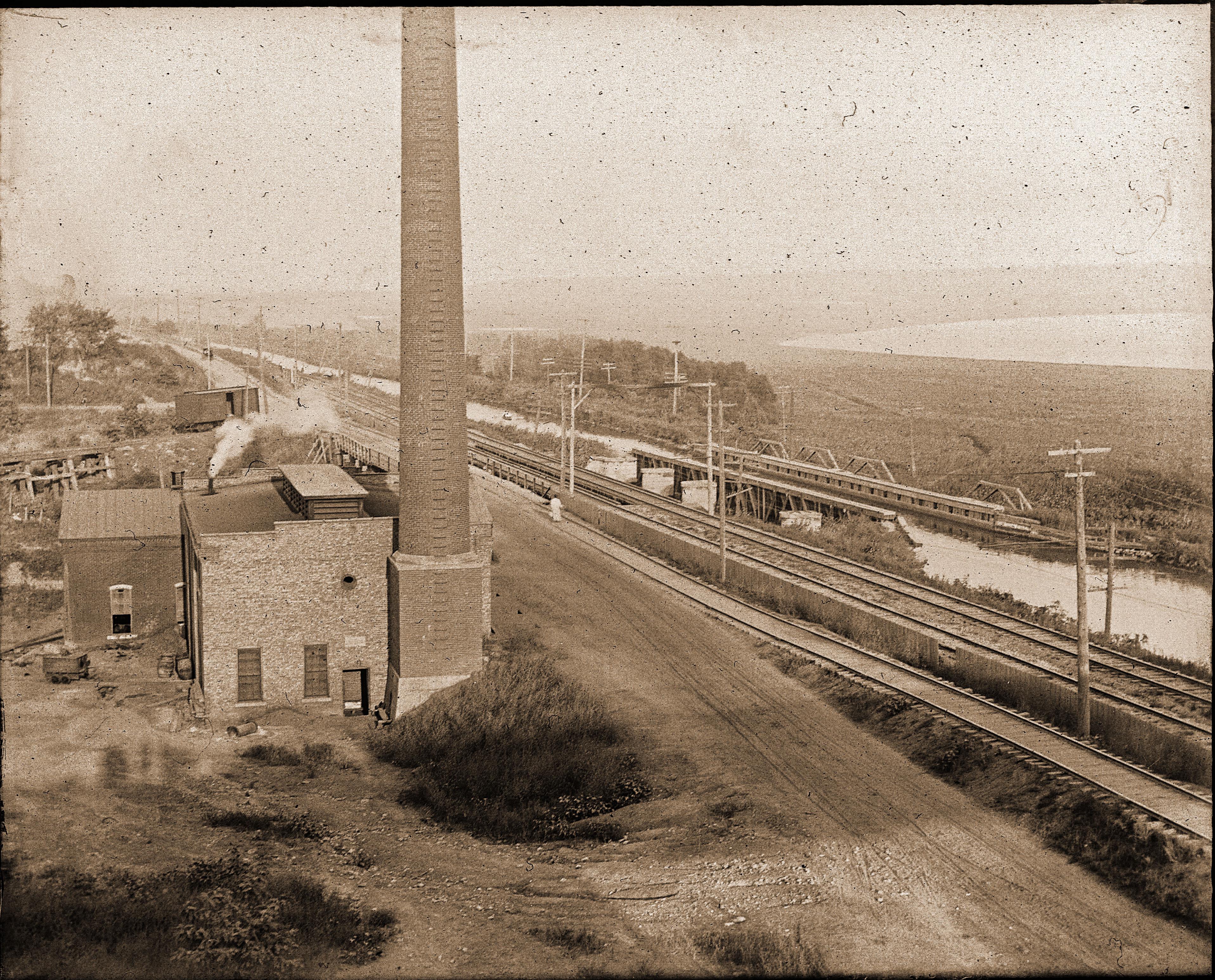
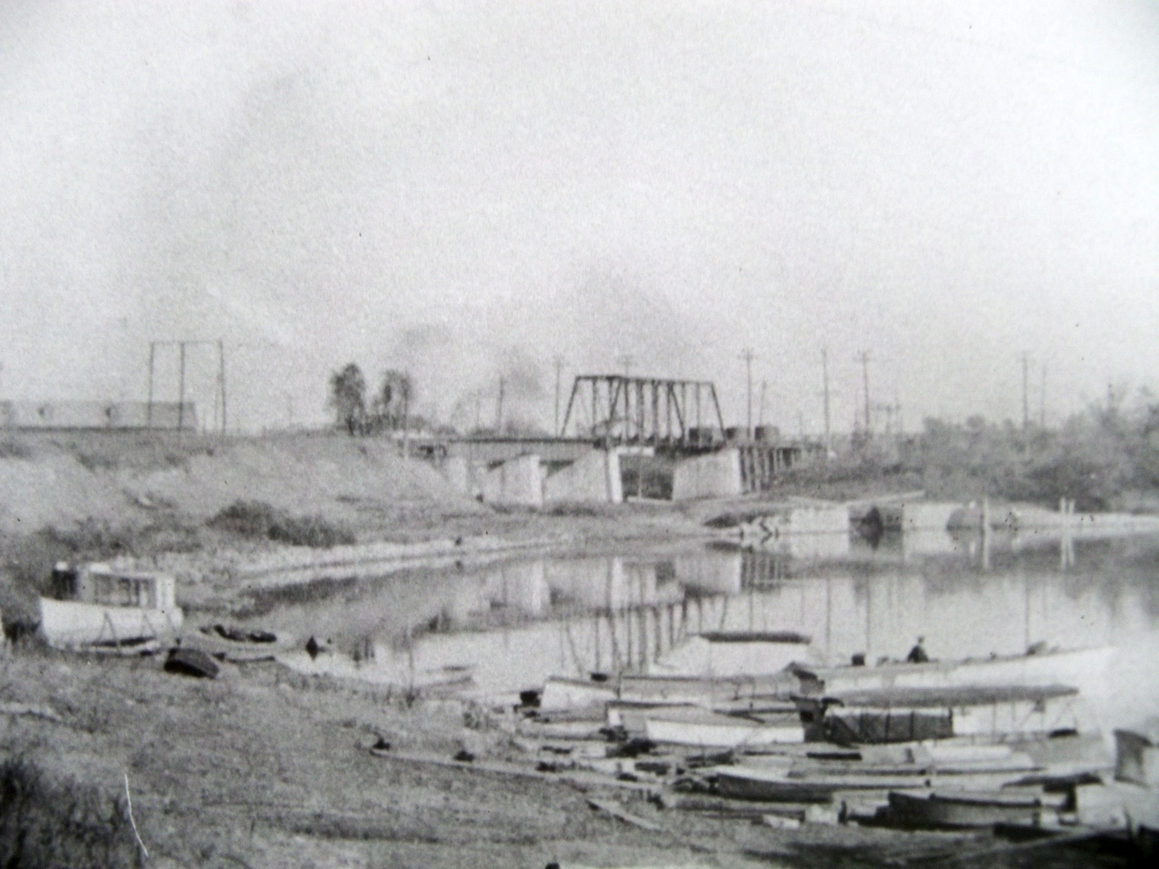
The photo below is quite interesting because it shows a railroad track above or north of the double track Rock Island
railroad. This track goes on to the roadway as it passes over the Vermilion river and I believe it went to Rockwell. Not sure.
But the track comes from the Coal mine of the LaSalle County Carbon coal co which you can see in view in the following picture.
The canal is at left. The tracks of the Interurban also went on this roadway crossing over the Interurban but did not begin
until 1906. If anyone else has any more info on this topic please let me know.
| View frim IC bridge looking eastward |
|
| From the Tom Romanowski collection |
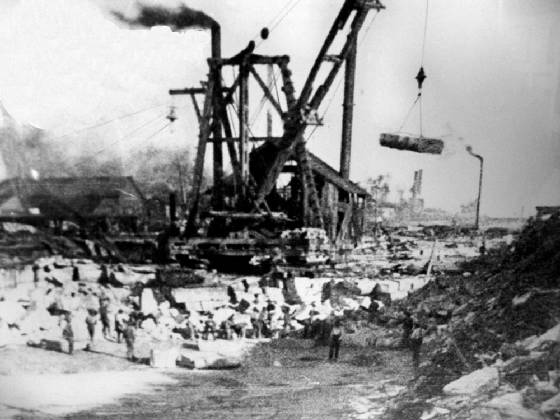
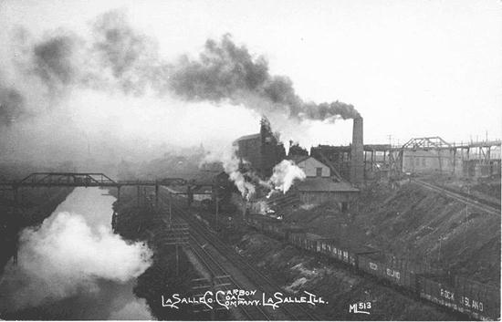
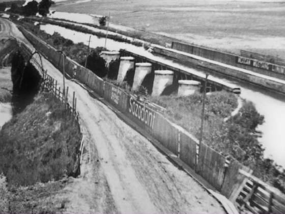
The revealing photo below tells us a whole bunch. The little wooden bridge crossing over the canal has a small
narrow gauge track on it to allow small pit cars or railroad cars filled with dirt, slag/shale/rock from the earth to be dumped
in a big refuse pile. Those piles and "hills" are still along the canal today just to the right of the I&M canal towpath
while you are walking eastward and just before you get to the old ICRR bridge. In the fall/winter when the leaves are off
the trees you can still see some of the concrete from the old mine!. The little trestle off to the
right where the road goes under was used to bring the coal over to the Illinois Central Railroad. The Rock Island Railroad's
coal was loaded down below where the string of railroad gondola cars are parked. At one time coal could be loaded into the
canal boats too. This was a big operation and the LaSalle County Carbon coal office is still standing on the southwest corner
of Union st and 1st st. Look at the east side of the building and see what it reads! The ICRR also
had a hill track that joined the Rock Island down below but adjacent to the area of lock 14 in the distance. That track is
not visible here but is behind the structure. It curves at the top of the hill just like it does today in 2013. It is simply
amazing the track is still in use as of 2013 but used for bringing in cement for the operation in Oglesby.
| Great view of LaSalle County Carbon Coal Co |
|
| Notice track going up hill near mine. ANother track going up to ICRR yard was behind the mine |
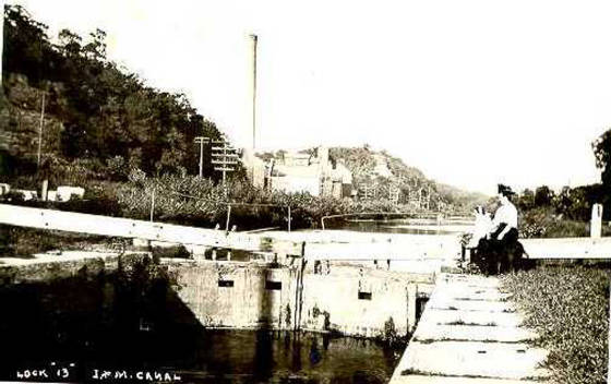
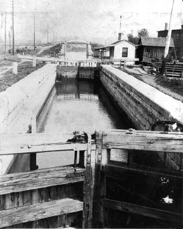
| Packet boat in lock 13 two miles west of Utica IL |
|
| Notice the Blackball mine in background |
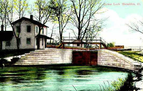
| Marseilles IL on the I&M canal |

|
| Ottawa IL on the I&M canal |
|
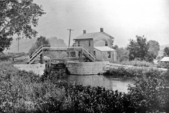
| Lock 13 between LaSalle and Utica |
|
| Blackball mine in background |
| Building the canal near lockport 1840s |
|
| Aqueduct in LaSalle IL |
|
| Lock 13 with Blackball mine in background |
|
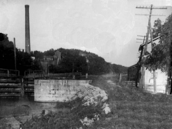
| Locktender's house to right |
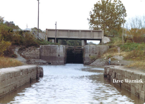
| The ole bridge over Lock 14 |
|
| 1981 Road was highway to Oglesby (bottom road) Photo taken from Lock 15 below. Good one Dave! |
| Ottawa IL Lock on I&M canal |
|
The following three photos were supplied by Larry Byrd. Thank you Larry!
| LaSalle looking at lock 15 area |
|
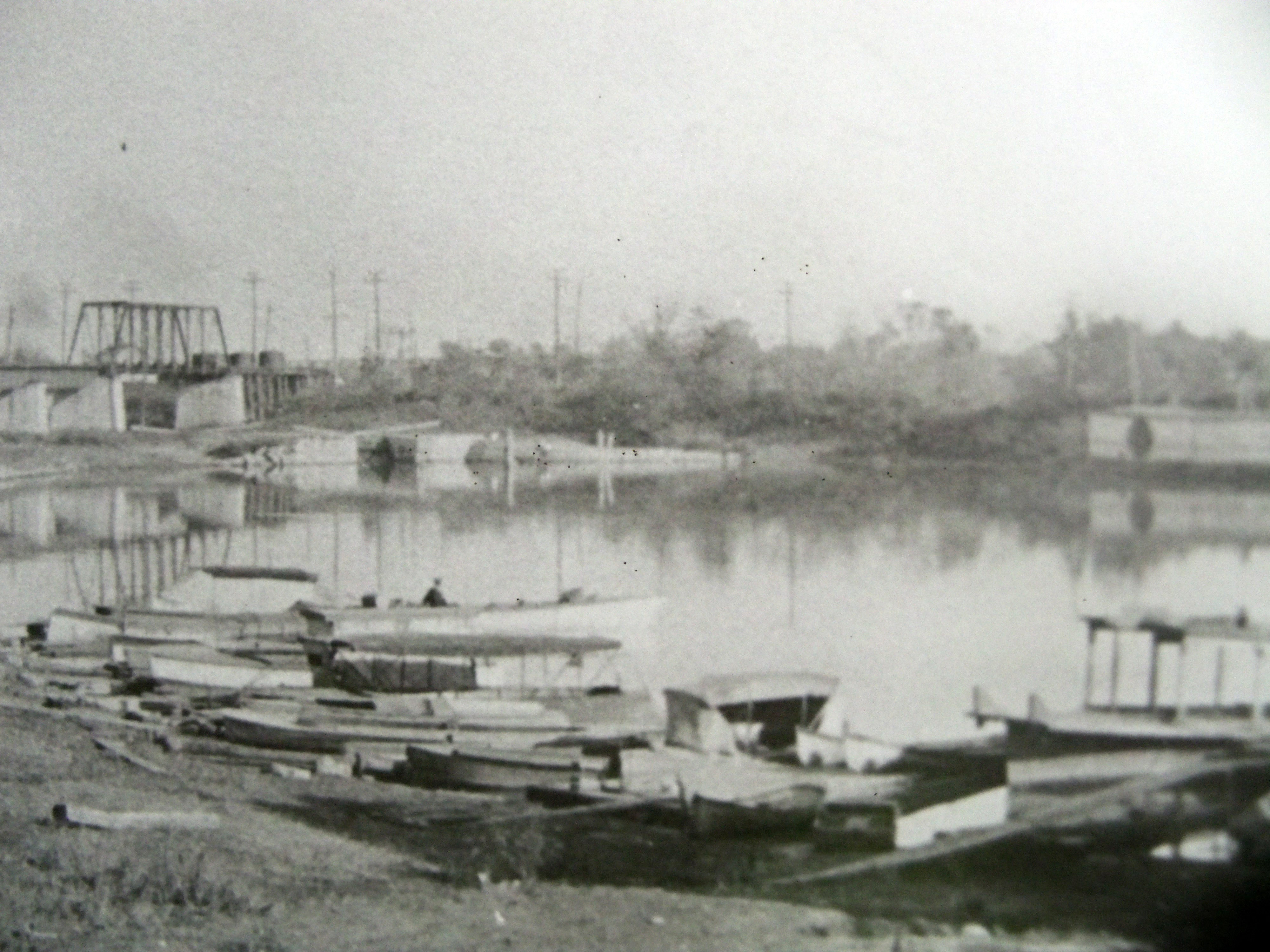
| Steamboat basin and CBQ bridge in view |
| Looking at lock 15 area |
|
| Steamboat basin in foreground |
| Grain Elevator near Lock 14 |
|
| Grain elevator was right next to Rock Island RR tracks |
Special thanks to Charlie Byrd for three photos above.
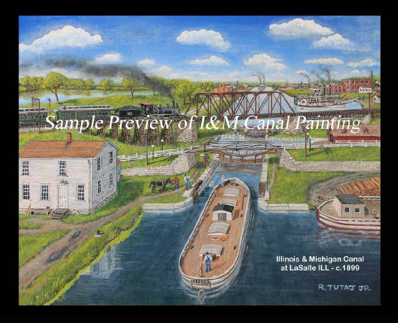
| Painting by Ray Tutaj 2012 |
|
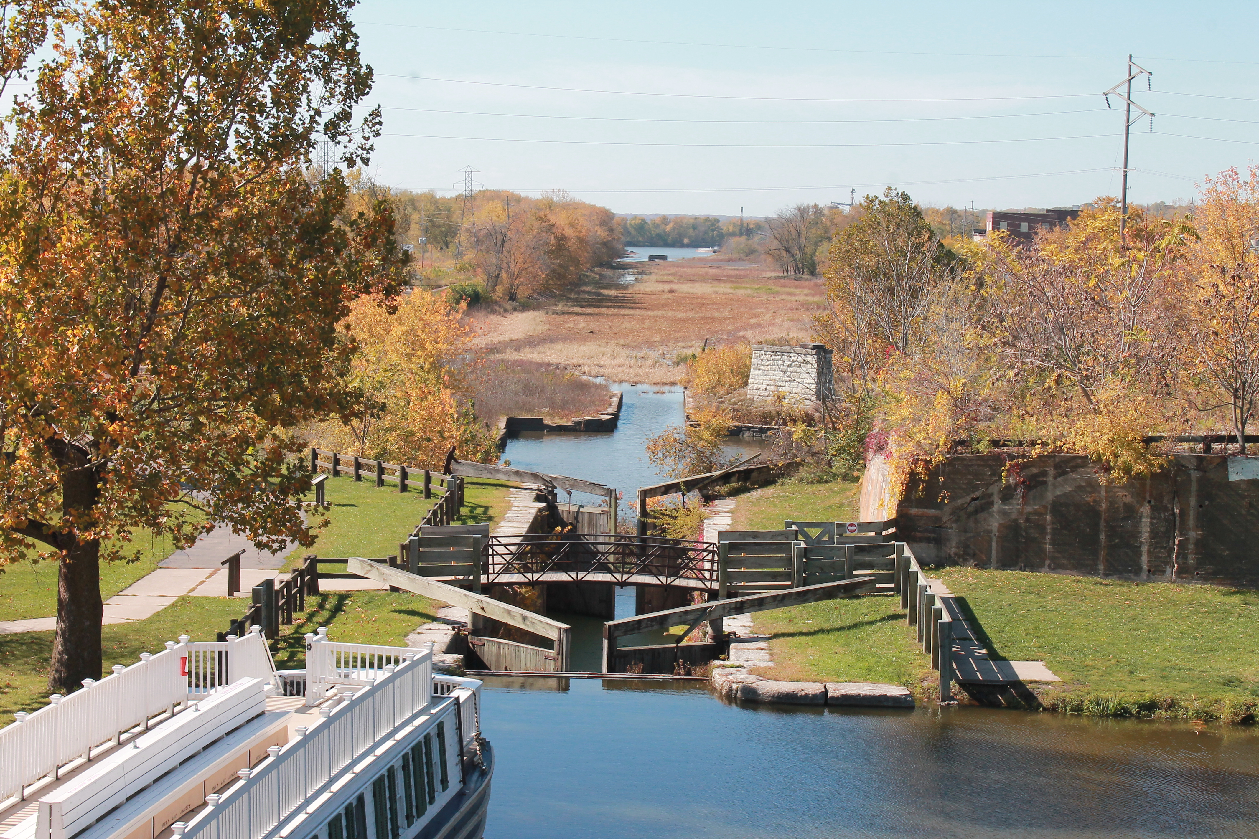
| The canal in 2012 |
|
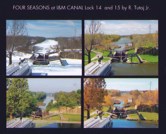
The "FOUR SEASONS" collage below was a couple years in the making. Getting the winter shot was the most difficult because
the sidewalk was usually full of snow. The summer shot could have been easier. The first one I got a few yrs ago I thought
would do but then I realized the Boat was not in the pic so I had to get one with it in view. I also tried to stand in the
same exact spot of course and zoom in a little on the Lock 14 and have some of the boat visible. I got a 16 x 20 made up and
some 8 x 10's and like the way they came out.
Ray Tutaj Jr July 7, 2014
|
| Photography by Ray Tutaj Jr. |
| Photo by Ray Tutaj |
|
| LaSalle IL 2010 |
| Canal Scene in 2009 at LaSalle IL |

|
| Photo by Ray Tutaj Jr |
| View of Lockport on I&M canal |
|
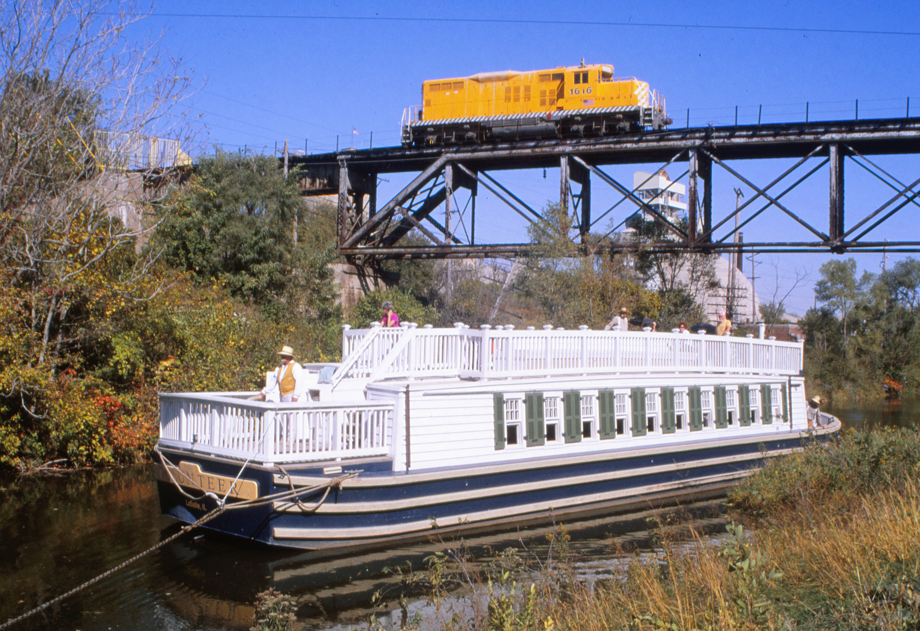
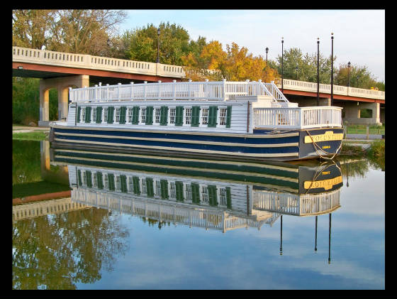
| LaSalle IL the Volunteer Canal Boat at Lock 14 |
|
| Photo by Ray Tutaj Jr |
Sharing things you might be interested in such as local history, photography, transportation,
a novel and art.
|